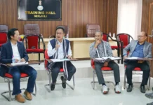
AALO, Aug 21: Hands-on training on geo-tagging was imparted to all the heads of offices and field staffs of West Kameng district by scientists from the Remote Sensing Application Centre (SRSAC) and the planning department during a programme here on 17 August.
Deputy Commissioner Sode Potom, who chaired the meeting, explained the importance of acquiring the knowledge on geo-tagging by all the works departments, stating that all the schemes submitted to the government would henceforth be application-oriented.
SRSAC senior scientist Timothy Nima said there may be some problems at the initial stage, but all departments need to take it up seriously. He said the government would shortly be issuing circulars to all the departments to incorporate the DPRs of all schemes for funding through geo-tagging.
Circle Officer Omey Apang and DPO Henge Riba also spoke.
Similar training was imparted to HoDs and field functionaries of Lohit district during a programme held in Tezu.
Deputy Commissioner Karam Leki informed the participants that the web-based portal would help in analyzing and monitoring projects on all levels of development, while Planning & Monitoring Director Mokir Ori said the portal would be a one-stop solution for information regarding execution of government projects under the NEC, RIDF, SIDF, MLALADS, BADP, etc.
“It will also enable transparency and accountability, besides better planning and decision-making,” he said.
The hands-on training on mobile application and dashboard (MIS entry) was imparted by an SRSAC team.
Technical Assistant Vikram Singh explained the concept of geo-tagging. (DIPROs)


