
 ITANAGAR, Sep 22: Local MLA Techi Kaso stressed that the master plan for the Itanagar capital region (ICR) should focus on development of the entire region, and that “the benefit of the villagers or land donors should not be compromised with.”
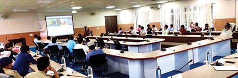
The MLA said this during a meeting of the Itanagar Planning Authority here on Tuesday to finalize the GIS-based master plan for the ICR.
He suggested to the town planning department to explore the possibility of colony-wise development, giving way to construction of new buildings in place of the old, dilapidated government quarters, so that the buildings may house “more number of families and save space for further planning.”
Doimukh MLA Tana Hali, who also attended the meeting, urged all the departments concerned to extend all possible help in implementing the plan.
He suggested that “some modalities should be worked out to solve the issue of encroachment on government quarters as it is the need of the hour and the same could be included in the master plan.”
ICR DC Komkar Dulom said that the master plan is “a comprehensive one, which will help in future programming.
“It would include every aspect of development, including health and educational sector, market issues, amusement parks, parking areas, etc,” he said.
He urged every department to work out modalities and submit their proposals for inclusion in the final plan.
The DC said house-mapping should be carried out to find out the actual resources available with the state government.
Town Planning Director Sukhvindar Singh informed that the master plan would be inclusive of all data and could be used for reference by any department.
He also informed that no land acquisition would be done as the intention of the plan is to regulate the growth of the town in a systematic manner. “The department will not acquire the land but help in developing the areas,” he said.
Prof Nishamani Kar from RGU also spoke.
Earlier, nodal officer Likha Suraj informed that the objective of formulating the GIS-based master plan for the ICR is to “develop a common digital geo-reference-based map and land use maps, using the geographical information system in each AMRUT city to enable them to make more strategic decisions.”
The union urban development ministry has selected the ICR as the lone AMRUT city of the state, and the project is being implemented by the town planning department.
Representatives of M/s Remote Sensing Instrument, Hyderabad, which has been awarded the work, made a PowerPoint presentation on the master plan for the ICR.
Papum Pare DC Pige Ligu also attended the meeting. (DIPRO)


