Staff Reporter
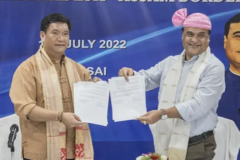
ITANAGAR, 15 Jul: Arunachal Pradesh and Assam on Friday edged closer towards a permanent settlement of their decades-old interstate boundary disputes by signing the ‘Namsai Declaration’.
The declaration was signed after the chief ministers of both the states – Pema Khandu and Himanta Biswa Sarma – held a crucial meeting with the cabinet ministers of the two states in Namsai to “restrict or minimise the boundary disputes between the two states in respect of 123 villages placed before the Local Commission by Arunachal in 2007,” the declaration read.
The two CMs agreed in principle to restrict the number of disputed villages to 86 from 123.
Twenty-eight villages which are within the constitutional boundary of Arunachal will remain with the state. The villages are Doimara, Pichola, Banderdewa, Upper Jumi, Balisori, Lika, Bali, Gogar, Jipu, Pale, Seren, Pam, Old Deka, Nari HQ, Depi, Depi Moli, Detak, Debing, Rayang, Ngorlung, Oyan, Tinali, Kangkong, Hazu Khuti Camp, Sunpura HQ, Mengkeng Miri, Longkhojan, and Ranglua.
With respect to Deopani Naga Gaon, Bare Gaon and Ponton Basti, claims were withdrawn by Arunachal and the three villages will remain with Assam.
“The location of six villages, namely, Khelong, Foot Hill, Tani Hapa, Richi Rite, Nyijir Koche and Ngopi could not be located on Assam side. Hence, if these villages exist on Arunachal side, these will continue with Arunachal Pradesh,” the declaration read.
“The regional committees will submit their first tranche of reports in the matter, including any other areas where consensus has been arrived at before 15 September this year,” it said.
As and when the regional committees conclude their deliberations and agreement is arrived at between the two governments, the draft MoU will be referred to the central government for approval.
The two CMs had met for the first time on the boundary disputes in January this year in Guwahati. They again met in April in Guwahati, during which it was decided, inter alia, that all boundary issues between the two states will be confined to those raised before the Local Commission in 2007.
“The boundary line delineated and signed on the 29 topo sheets by the High Powered Tripartite Committee as notified boundary during 1980 would be taken as the basis for realignment of boundary by both states,” the declaration said.
It was also decided that both the states will constitute 12 regional committees each, covering the 12 districts of Arunachal and Assam, “for joint verification of 123 villages and recommendations to respective state governments, keeping in view the historical perspective, administrative convenience, contiguity and people’s will to delineate interstate boundary between Assam and Arunachal,” it read.
Accordingly, both the state governments notified the regional committees last month.


