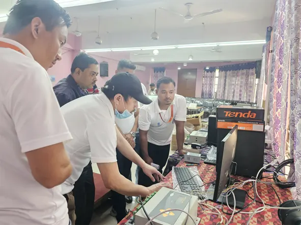
GUWAHATI, 22 Dec: In a significant stride towards enhancing safety and precision in aviation, a comprehensive three-day training programme on installation, calibration, and maintenance of the heliport aviation weather observing system (HAWOS) was conducted at the regional meteorological centre here in Assam from 20-22 December.
“The observation system installed at helipads converts text weather data to voice and communicate to airborne pilot up to 50 to 100 kms range for taking decision to land at a particular heliport or airport,” Arunachal Pradesh Centre for Earth Sciences & Himalayan Studies Director Tana Tage informed in a release.
The programme was divided into three sessions. During the first session, the participants were acquainted with the theoretical foundations of the HAWOS, exploring its principles, equipment, importance, and future implications.
The second session was focused on GIS and remote sensing. It also featured a hands-on training session, encompassing the basic concepts of remote sensing and open-source GIS software, as per government protocols, the release said.
The last session delved into the practical aspects of the HAWOS, providing the participants with firsthand experience in arrangement, alignment, connection, installation, calibration, and configuration of HAWOS equipment data loggers.
Tage in his address emphasised “the value of collaboration and data-sharing, as outlined in the memorandum of understanding,” while the India Meteorological Department’s Guwahati-based regional meteorological centre Scientist-F Dr Sanjay Neil Shaw said that “the collaboration would significantly contribute to avoiding incidents and accidents during helicopter operations in Arunachal Pradesh, addressing the historical challenges of inadequate meteorological information during crucial landings and take-offs,” the release said.
Certificates were later distributed to the participants.

