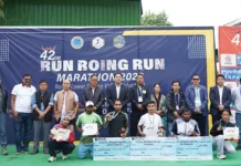
RONO HILLS, 17 Oct: A 10-day training programme on ‘Remote Sensing and Geographic Information System (GIS)’, organized by Rajiv Gandhi University (RGU) in collaboration with Shillong (Meghalaya)-based North East Centre for Technology Application and Reach (NECTAR), concluded here on Friday.
The programme, which had begun on 6 October, was aimed at building the technical capacity of the participants in the field of geospatial technologies for natural resource management, planning, and sustainable development.
Earlier, in his inaugural address, RGU Environmental Sciences Dean Prof Sailajananda Saikia emphasized the need for skill-based training to enable participants to apply remote sensing and GIS tools in academic research and field-based studies.
While providing an overview of the training’sobjectives, modules and expected outcomes, programme convener Prof SK Patnaik highlighted the growing importance of geospatial technologies in environmental monitoring, disaster management, and developmental planning.
NECTAR Director General Dr Arun Kumar Sharma also addressed the participants through the online mode and encouraged them to make the best use of the opportunity being provided at their doorstep to enhance their technical competencies.
RGU Geography HoD Prof Gibji Nimasow and Prof Tage Rupa also addressed the participants on the occasion.
Over the course of 10 days, the participants were exposed to both theoretical and practical aspects of remote sensing and GIS. The training covered modules on satellite image interpretation, digital image processing, spatial data analysis, land use/land cover mapping, NDVI calculation, and geospatial modelling using leading GIS software platforms such as ArcGIS Pro and ERDAS Imagine.
The sessions were conducted by experienced resource persons and domain experts from the NECTAR. They provided hands-on training and shared case studies demonstrating real-world applications of GIS in agriculture, forestry, disaster management, and urban planning. The participants also visited Ziro valley in Lower Subansiri district with the aim of gaining practical knowledge and hands-on experience in GPS-based field data collection, with emphasis on the use of satellite navigation systems.
Addressing the valedictory function, RGU Vice-Chancellor Prof SK Nayak urged the participants to apply their newly acquired skills in their respective professional and research domains.


