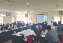
ITANAGAR, 24 May: The Arunachal Pradesh Space Application Centre (APSAC) here on Friday organised a meeting to evaluate the output of a pilot project on ‘Natural resources inventory for micro-level agricultural planning (NRIMAP) of Tawang, Lower Subansiri and Namsai Districts on 1:10k scale’.
“The project is aimed at developing large-scale soil resource map, land degradation map, land irritability map and land capability map of the selected three pilot districts. Formulated in the line of the Centre’s initiative ‘per drop per crop’ to boost and doubling of farmers’ economy, the project will also help generate location-specific optimal cropping recommendations for agriculture/horticulture and land and water resources development plan for overall sustainable development of the selected districts.
“Besides these, web GIS and mobile application are also being developed for farmers of these districts,” informed a press release.
During the meeting, APSAC Joint Director Dr Liagi Tajo presented a brief on the project work, which was followed by a detailed presentation on the NRIMAP project.
Resource persons and officials attending the meeting discussed the objectives, methodology and output of the project.
The meeting was attended also by, among others,APSAC Director Dr H Dutta, Joint Director (Agriculture) Debia Tada Neckom, and Deputy Director (Tech) CK Manlong.


