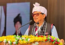
ITANAGAR, Aug 9: A training programme on the use of web portal and mobile application for satellite-based monitoring and geo-tagging of developmental projects in the state was conducted by the planning & investment department in collaboration with the capital complex administration at the Dorjee Khandu State Convention Centre here on Thursday.
The use of geo-tagging is expected to bring transparency and accountability, and result in better planning and monitoring of projects.
Deputy Commissioner Prince Dhawan lauded the initiative, and advised the participants to coordinate for successful implementation of the project. He also asked every department to identify two projects each for geo-tagging during field visit on Friday.
Planning Deputy Director Tana Tage made a presentation on satellite-based monitoring and geo-tagging of development projects in Arunachal Pradesh, while a technical team from the State Remote Sensing Application Centre (SRSAC) explained and presented a live demonstration on various modules of mobile application, and the web-portal dashboard.
Planning Director Mokir Ori, the SRSAC director, administrative officers, and executive engineers and assistant engineers of all the line departments of the capital complex attended the programme. (DIPRO)


