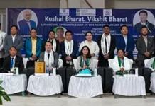
ITANAGAR, 7 Feb: A two-day hands-on training programme on ‘Remote Sensing (RS) & GIS and PM GatiShakti (PMGS) portal’, conducted by the RWD’s Soil & Water Conservation (SWC) Directorate under its training and capacity building programme, concluded here on Friday.
The comprehensive training programme covered various topics on the concept of RS/GIS, hydro-geomorphical mapping, land use/land cover map, watershed delineation, LiDAR survey, and other RS & GIS applications in the state.
A special presentation on PM Gati Shakti portal was also arranged to enhance and upskill the departmental functionaries involved in programme planning, implementation of various soil and water conservation programmes, and land-use planning.
A publication on land resource database study of West Kameng district was also released during the event.
The technical partner of the programme was the Arunachal Pradesh Space Application Centre (APSAC) under the Science & Technology Department. About 80 senior and middle level officers and technical functionaries of the department took part in the programme.
SWC Director Joram Puppa commended all the participants and the resource persons of the APSAC for their effort in customising the programme content as per the requirement.
APSAC Director Dr H Dutta encouraged the participants to “integrate RS and GIS technologies into the design and planning of land-based programmes for increased synergy and effectiveness.” He also highlighted various key initiatives of both the state and the central governments towards utilisation of space technology for sustainable development.
Soil Conservation Officer RD Mosobi, who was the programme coordinator, also spoke.


