[ Amar Sangno ]
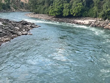
SEPPA, 7 Nov: The water of the Kameng river in East Kameng district has become clear after a year of being turbid.
A massive landslide had occurred in the Wapra Bung – one of the tributaries of the Kameng – in the Himalayan glacial region on 28 October, 2021, resulting in high turbidity of water and loss of large numbers of aquatic lives.
The Kameng river’s muddiness and turbidity had caused great concern among environmentalists and geological experts. The river took a year to recover from the high turbidity and muddiness.
Independent researcher and geographer Chintan Sheth, who trekked all the way up to the Kameng river’s origin, near Khyarii Satam, in November 2021, had reported that “the geomorphic stresses were eased by the earthquakes that occurred unexpectedly in the region, which triggered a massive landslide and flow of heavy debris.”
The Kameng river has three major tributaries – Waibung, Pachuk, and Waprabung.
Sheth also reported that “the valleys in the tributaries are composed of permanent ice (glaciers), rock, snow and steep mountain slopes that rise up to an altitude of 6,000 m+ ridge, separating Arunachal Pradesh and Tibet.”
“If turbidity and muddiness have reduced, then that is a good sign, indicating that it is recovering,” said Sheth.
“The problem is, we don’t have water quality data from when the incident occurred. Due to government limitations, the study could not be continued into the next year after the incident,” he added.
Sheth opined that “other ecosystems upstream will take very long to recover because the entire riverine tree cover vegetation was stripped. That will take decades to recover to pre-landslide condition.”
Expressing concern over the habitats and aquatic lives, Sheth said, “Further upstream, many habitats have changed, and the river no longer has large pools like it used to have before the incident. So, that, too, needs investigation.”
On 13 October, 2021, the earth sciences ministry’s National Centre for Seismology detected a shallow earthquake of 3.4 magnitude near a ridge separating the Kameng river and the Wapra Bung river. Subsequently, on the 30th, another earthquake of 3.4 magnitude occurred 46 kms southwest of the area.
Satellite images of the area before and after 13 October did not reveal any detectable change in the geomorphology. No landslides were observed. However, by the 29th, the river was already heavy with sediments.
Meanwhile, Kolkata-based Centre for Climate & Environmental Studies Head Punyasloke Bhadury, who studied the turbidity in the Kameng river, said, “I think the main factors are following: no further glacial shift and resulting flow of debris; settling of sediment, as well as downstream deposition of sediment due to changing velocity of water; and possible trapment of sediment particles by microbes resulting in improvement of turbidity conditions.”


