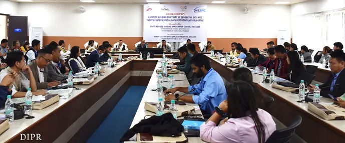
ITANAGAR, 30 Mar: A two-day workshop themed ‘Capacity building on utility of geospatial data and the northeastern spatial data repository portal’, being jointly conducted by the State Remote Sensing Application Centre (SRSAC) here and Shillong (Meghalaya)-based North Eastern Space Applications Centre began at the DK Convention Hall here on Thursday.
Addressing the inaugural session, Science & Technology Director CD Mungyak encouraged the participants to acquire as much knowledge as possible from the workshop.
Citing the example of Google Maps, which uses geospatial data, he said, “The data repository gathered as such is increasingly helping us in more ways than one.”
Earlier, SRSAC Scientist-C Dr Swapna Acharjee informed that the “SRSAC, which was established in 1996, is now functioning as an independent organisation under the state’s science & technology department and acts as the nodal centre for remote sensing application programmes in the state.”
She further informed that “the SRSAC utilises state-of-the-art remote sensing and GIS technologies for inventory, mapping and monitoring of natural resources and planning for their sustainable development, and for effective rural and urban development planning in the state, and taking up research/projects addressing various environmental problems and hazards in the state.”
“The mission of the SRSAC is to generate geospatial datasets and create user-friendly applications through web-enabled distribution tools for government departments to serve as an effective tool for decision-making, planning, implementation and monitoring purposes, to integrate state-of-the-art remote sensing, geographic information system, and global positioning technologies with on-the-ground knowledge of ecosystems and natural resource management to address relevant issues, to transfer knowledge and skills to the community, academicians and government departments through education, outreach and training, and to provide core geospatial dataset (administrative boundaries, road, railway, and major settlement, etc) to all the departments in the state,” Dr Acharjee informed.
Officials of around 17 government departments of the state are participating in the workshop. (DIPR)


