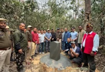
ROING, 4 Nov: In a step towards realising the vision of becoming a developed and tech-driven Arunachal Pradesh, the Arunachal Pradesh State Remote Sensing Application Centre (APSRSAC) inaugurated a drone port here in Lower Dibang Valley district on Tuesday.
The initiative marked a major milestone in leveraging drone technology for scientific planning, real-time monitoring, and evidence-based decision-making across departments.
Deputy Commissioner Fwwrman Brahma commended the APSRSAC’s pioneering efforts and called for optimal use of the drone port for better planning, transparency, and governance efficiency. He noted that drone-enabled monitoring would play a vital role in ensuring faster project implementation and improved public service delivery, especially in geographically challenging terrain.
APSRSAC Joint Director Dr Liagi Tajo said that the establishment of drone ports across the state aligns with the chief minister’s broader vision of integrating technology into all sectors of governance. He also highlighted the APSRSAC’s ongoing efforts to strengthen digital infrastructure through the Arunachal Pradesh State Spatial Data Infrastructure and the Arunachal Monitoring System to ensure seamless access to spatial data for all line departments.
The APSRSAC technical officer explained the significance of a drone port as a dedicated operational hub equipped for UAV take-off, landing, charging, maintenance, and data transfer. He said that the Roing drone port would be instrumental in aerial mapping, forest and agriculture monitoring, mining surveillance, infrastructure assessment, disaster response and skill development.
APSRSAC Deputy Director Nyelam Tath reiterated the Centre’s commitment to expanding drone-based applications to every district. He said that the APSRSAC’s efforts directly contribute to the state’s mission of achieving a digitally empowered, innovation-led Arunachal.
The district disaster management officer and the district agriculture officer highlighted the potential of drones in disaster preparedness, agricultural productivity assessment, and sustainable resource management.
The Roing drone port is envisioned as a strategic hub for aerial data collection, analysis, and operational coordination, linking field activities to state-level decision-making systems. The facility will act as a model for future drone infrastructure across the state, enhancing efficiency, transparency, and technological adoption in governance.
A drone demonstration was also conducted. (DIPRO)


